

Pax ski jump readied for future F-35B Lightning II launches
U.S. Navy photo/Jennifer Amber
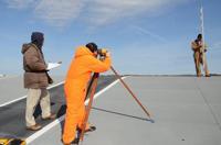
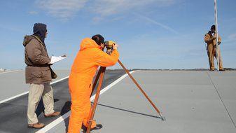
The Atlantic Test Ranges Geomatics and Metrology team, from left, Fred Hancock, Sung Han and Warren Kerr survey the ski jump ramp that was assembled at Naval Air Station Patuxent River in 2009 to document potential deviations from the original design plan.
By Sarah Ehman
Atlantic Test Ranges Business Communications
Thanks to a partnership between the Atlantic Test Ranges (ATR) and the F-35 Lightning II Pax River Integrated Test Force (ITF), the Joint Strike Fighter took one step closer this Spring to making its debut on international ships.
The Pax River ITF partnered with ATR’s Geomatics and Metrology team to perform a high fidelity survey of the shore-based ski jump at Naval Air Station Patuxent River’s center airfield. The survey is a prerequisite to future F-35B flight testing by the Pax River ITF, the United Kingdom and Italy.
The shore-based ski jump at centerfield was built in the United Kingdom, divided into sections, then transported and reassembled at Pax River.
“Launching off our Pax ski-jump paves the way to F-35Bs launching off our international partner ships that feature ski-jumps,” said Bob Nantz, the Pax River F-35 ITF external environment and performance lead. “The significance of the Pax ski-jump shape is connected to aircraft loads and performance modeling. Ideally, the loads will never limit the launch weight or speed, thus allowing the maximum performance benefit.”
Together, Fred Hancock, Sung Han and Warren Kerr, each with ATR Geomatics and Metrology, employed electronic differential leveling and total station measurement techniques to check for drift in construction and determine precise deviations in both vertical and horizontal components of the ramp.
“We captured hundreds of elevation readings, determining the relative vertical difference between points,” Hancock said. “We also obtained precise angular distance measurements to determine if the ramp edges were parallel to the center line. This helped us to know whether the ramp was at all skewed.”
Hancock noted that the team achieved readings accurate to within one millimeter — approximately the thickness of a credit card.
“The razor-sharp accuracy of the Geomatics team’s survey is a key part of the process leading to future ski-jump operations at sea,” Nantz said.